
Client ·Sep 2026 → ongoing
D'Weekendr
A Tobago leisure concierge's website, rebuilt from WordPress on its owner's own words and pictures, and Tobago Explorer Essentials: a 3D map of the island in her drawn icons, with 256 places, directions to each and a page for every one. A draft with its owner, not yet launched.
- Timeframe
- Sep 2026 → ongoing
- Tags
- Travel and leisure · sveltekit · three.js · cloudflare
- Credits
- Xern Mottley — Engineer
Where it started
D'Weekendr Leisure Hub is a leisure concierge in Tobago: retreats, day trips, private drivers and a virtual assistant for people planning time on the island. Its website is on a WordPress.com plan that allows no code of its own. As it stood on 30 September 2026, it held 121 pages and 43 forms, eight links to pages that answer "not found", and not one picture described for a screen reader or a search engine.
That day the owner asked for something her plan could not run: a map of Tobago whose navigation is her own drawn key. Tap pharmacies and every pharmacy on the island appears; tap one for directions in Google Maps, Apple Maps or Waze; find the trails and waterfalls with a video or one of her drawn trail maps. The map was prototyped as an app of its own, and her site captured whole to be rebuilt around it.
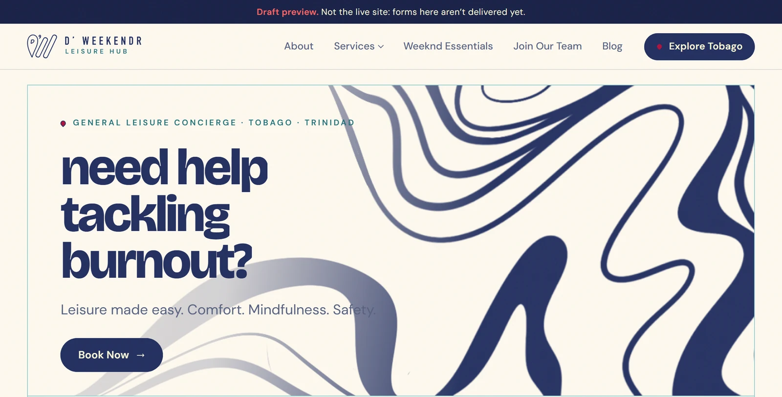
Her WordPress site as captured on 30 September, and the draft on 16 October: her pages at the addresses they had, every old address forwarded, her pictures described, and the map she asked for.
What was done
Her site came across whole: 115 of her 121 pages at the addresses they already had, with her words, her pictures and her colours. The other six, past events and a duplicate form, forward to where they belong, as do 364 old addresses in all. Every page is built ahead and served as a file. Descriptions were written for 339 pictures, her reels play as short silent previews, and a blog waits for her posts.
Each page tells search engines and AI assistants what it is, in its own first sentences and in structured data that says only what the page shows. Every place on the map has a page of its own, which is what a search finds.
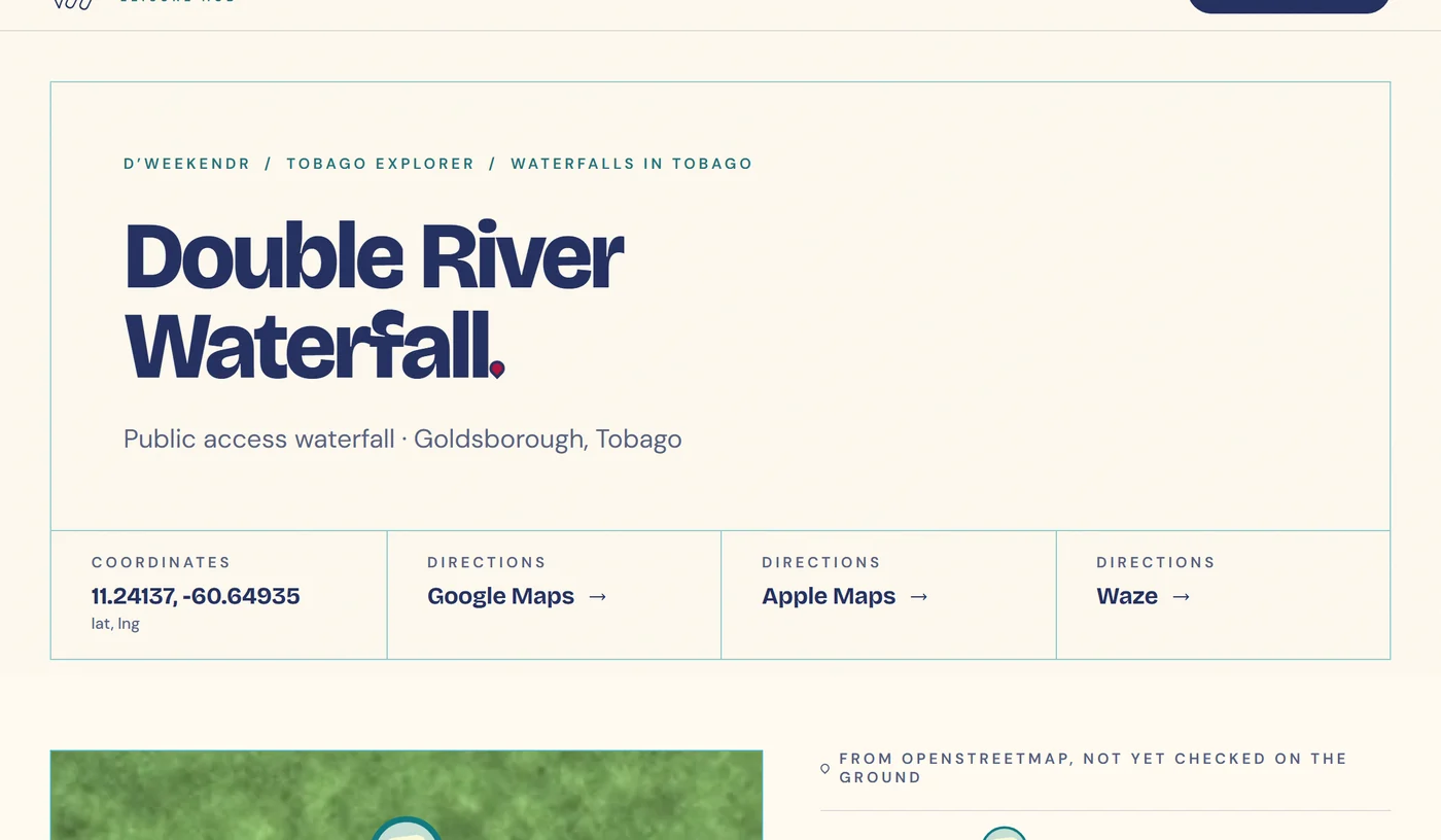
What a search finds: one of the 256 place pages, in the site's own frame, with its directions in three apps. From the draft, 19 October.
Tobago Explorer Essentials is the map she asked for. The island stands in 3D under her drawn icons, with 256 places in 16 kinds from OpenStreetMap and her own additions. Each place has directions in the visitor's choice of app, and twelve topic pages group them for search. It keeps Tobago's own time, so it darkens at night, and it has a street map and a button that finds what is nearby.
Every place lives in one sheet, and everything a visitor or a search engine sees is built from it. A place marked "on request" leaves no trace in what ships, and the check after the build fails if one does: her brand is to be discovered, not broadcast.
One sheet holds every place. The build gives a beach its second kind and leaves out, whole, any place told on request; everything a visitor or a search engine sees is built from what remains.
On 16 October her admin was built on OPI's client admin kit: the requests her forms bring in, bookings, payments and clients, and her catalogues, posted from it as books that turn.
The decision that mattered
A map has to read as a map before it can do anything else. Walking through it on 7 October, we could not read ours: the island was a green blob, the roads and rivers could not be picked out, and every crowd of places showed a fork and knife with a number, whatever it held.
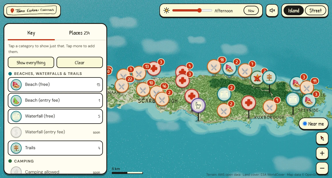
Before, 7 October: the island at overview as the walk-through found it. The trees hide the roads, and every crowd of places shows a fork and knife with a number.
The cause was the drawing itself. Eighteen thousand 3D trees stood over a ground texture that already painted the forest, the roads and the rivers, so from any height they hid all three. The decision was to let the ground carry the whole island and give each layer of detail the distance at which it can be read.
What the island draws as the camera comes closer, read from the map's own code: main roads and the destinations from any height, the trees only where they can no longer hide the roads.
The trees now grow in under 19 km and stand full under 6; houses arrive under 16 km; the main roads show from any height. Beaches, waterfalls and trails come first, practical stops such as pharmacies under 36 km, food and cash under 15.
A crowd of places became a pill showing the icons of what is in it and how many. North is up, and the island fits the part of the screen the key leaves open.
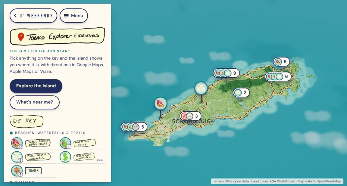
After: the map's first screen on the draft today, lit for the afternoon like the before. Her drawn key beside the island, the roads and rivers on the ground, and each crowd a pill showing what is in it and how many.
The same walk-through cut what the map loads from about 3.4 MB to about 2.0 MB. Her key's artwork had been 2.2 MB of pictures five to ten times larger than the places they fill, and became 0.5 MB. The title and the key now work before the island has finished drawing.
Where it stands
A draft, not launched. It went to the owner on 8 October, hidden from search engines, and dweekendr.com is still her WordPress site.
Her notes came back as five pages of screenshots marked up by hand, and were built on 15 October: a black overlay at her own strength on every cover photograph, her red as the accent in place of the pink, four more kinds of help on the assistance form, one Services menu, and five beaches that now show under restrooms and showers. Each beach stayed one place with a second kind, not a second pin.
From her voice note on 30 September to her admin on 16 October: the draft with her on the eighth day, her edits built a week later.
Her illustrations went in the next day, and her admin is built but not yet in her hands. Before the site can go live, its forms must reach her inbox, dweekendr.com and its email must move across, and the new site must be put in front of search engines. The captures here are the draft's, from 7 and 19 October; the pictures and drawings in them are hers.
Next — Noble Link →